Puerto Vallarta Cruise Port: Essential Visitor Guide
This post may contain affiliate links. I may earn a small commission at no extra cost to you.
Puerto Vallarta cruise port gives travelers a convenient gateway to Mexico’s Pacific coast. Located on Banderas Bay in Jalisco, the port places visitors near downtown sights, beaches, local restaurants, and excursions across the Mexican Riviera.
Cruise passengers can reach Puerto Vallarta’s downtown, beaches, and major attractions during a typical port day, with taxis, rideshares, buses, and organized tours available. The terminal’s location and transport options help travelers choose between exploring independently and booking activities such as boat trips, nature tours, and adventure excursions.
This guide covers the port’s piers and facilities, ways to get around, practical planning details, and the best places to visit before the ship departs.
Terminal Location, Piers, And Facilities
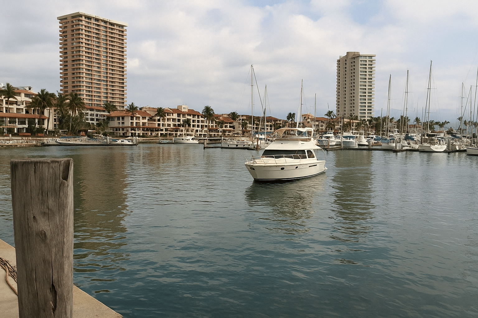
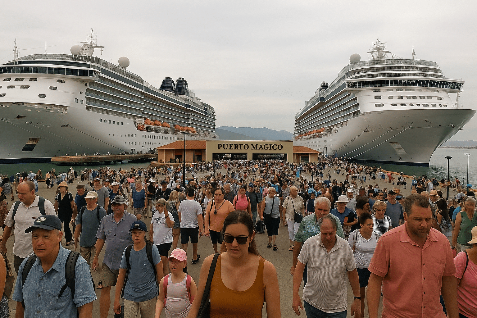
Puerto Vallarta’s cruise port operates from Puerto Mágico in the Marina Vallarta area, north of the city center. The terminal provides controlled entry, passenger services, shops, dining, and transportation access, while downtown, the Hotel Zone, and Licenciado Gustavo Díaz Ordaz International Airport remain a short drive away.
Puerto Mágico and Dock 1
Puerto Mágico serves as the main passenger complex at the Puerto Vallarta cruise port. It sits beside the Marina Vallarta maritime and cruise terminal, where visiting ships use dedicated berths rather than docking in downtown Puerto Vallarta.
Dock 1 handles many cruise calls, although the assigned berth can change according to ship size, scheduling, and port operations. Passengers should check the ship’s daily instructions because the walking route from the gangway to the terminal gate may vary.
The complex includes paved access areas, shaded sections, restrooms, commercial spaces, restaurants, and pickup zones. Royal Caribbean passengers and guests from other cruise lines can usually reach taxis, private transfers, and organized excursions after passing through the terminal gate.
Terminal Gate Services and Nearby Shopping
The terminal gate controls movement between the ship area and public facilities. Security screening, port personnel, and transportation staff direct passengers toward taxis, tour operators, accessible vehicles, and meeting points.
Puerto Mágico includes retail shops, food outlets, souvenirs, pharmacies, and convenience services. Galerias Vallarta, a larger shopping center near the port, offers additional stores, restaurants, and practical services within a short taxi ride. Prices and opening hours can vary with ship schedules.
Passengers meeting tour guides should confirm the exact pickup location before leaving the ship. Taxis typically operate from designated areas, while private drivers may meet guests at an assigned terminal exit. The port’s facilities primarily support short visits, so passengers needing extensive shopping or banking services may prefer downtown or Galerias Vallarta.
Distance From Downtown and the Airport
Puerto Mágico lies in Marina Vallarta, north of central Puerto Vallarta and beside the Hotel Zone. Downtown attractions such as the Malecón, Zona Romántica, and Los Muertos Beach generally require a road transfer rather than a walk from the cruise terminal.
The terminal is approximately 5 kilometers from Licenciado Gustavo Díaz Ordaz International Airport. Travel time often takes about 10 to 20 minutes, depending on traffic and terminal congestion.
Downtown Puerto Vallarta usually takes about 15 to 25 minutes by taxi or private vehicle. Traffic can increase during peak arrival periods, so passengers with limited port time should allow extra time for returning to the ship. Taxis, app-based services where permitted, and prearranged transfers provide the main transport options.
Getting Around From the Ship
The cruise terminal sits north of central Puerto Vallarta, so passengers should choose transport based on time, cost, and destination. Yellow taxis, city buses, walking routes, shuttle services, and organized shore excursions each suit different plans.
Yellow Taxis, City Taxis, and Ride-Hailing
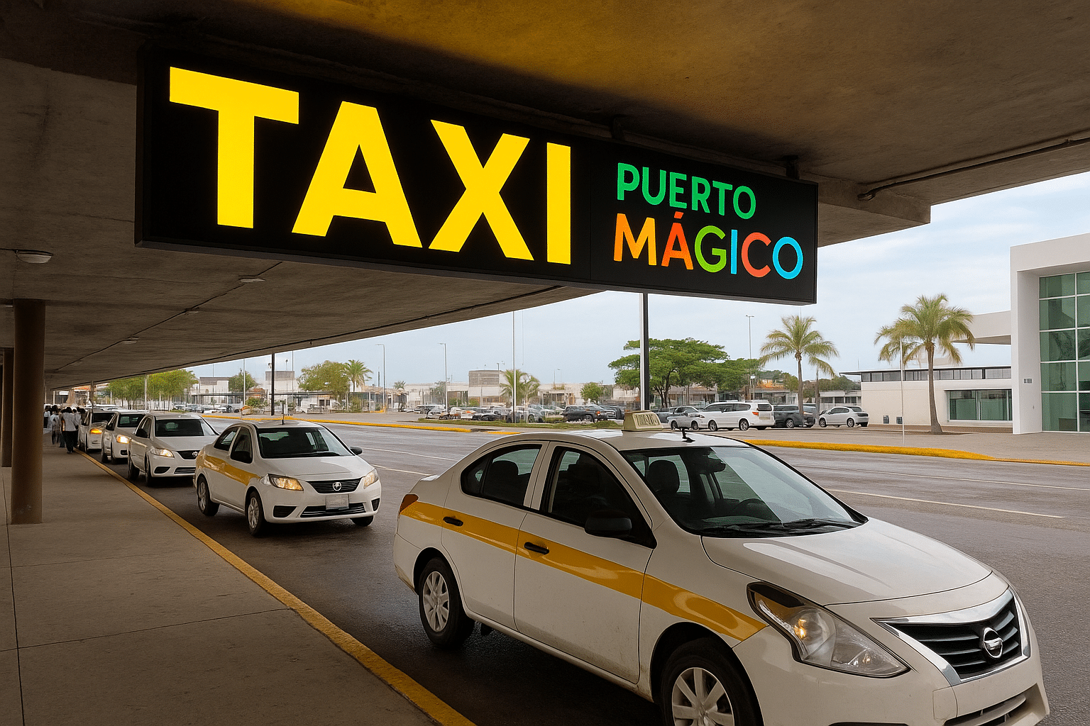
Yellow taxis wait near the cruise terminal and serve passengers leaving the ship. They usually charge by zone rather than by meter, so travelers should confirm the fare and destination before entering. Drivers commonly accept Mexican pesos (MXN); some accept U.S. dollars, but the exchange rate may be unfavorable.
City taxis operate within Puerto Vallarta and often cost less for short trips once passengers reach a main road. The terminal’s authorized taxi area can provide current zone pricing. Ride-hailing services may have pickup restrictions at the port, so passengers should check the app’s meeting point and avoid leaving the terminal without clear instructions.
Using the Centro Bus
The local bus to Centro, also called El Centro, offers an inexpensive way to reach central Puerto Vallarta. Passengers typically walk from the terminal toward the main road and look for buses marked for the downtown area; the exact stop can change, so port staff or the driver can confirm the route.
Passengers should carry small Mexican peso bills or coins because buses generally accept cash and may not provide change. The ride can take longer than a taxi because of traffic and frequent stops. Travelers with limited time should allow extra time for the return trip and avoid relying on the bus immediately before the ship’s all-aboard time.
Walking, Shuttles, and Return-Time Planning
The cruise terminal area includes shops and services, but El Centro is several miles away and usually requires a taxi, bus, or organized transfer. Walking may work for nearby attractions along the waterfront, yet heat, traffic, and limited sidewalks can make longer routes uncomfortable.
Some cruise lines and shore excursions provide scheduled shuttles to central Puerto Vallarta, beaches, or resort areas. Passengers should confirm whether the service is included, where it departs, and when it returns. Independent travelers should keep the ship’s all-aboard time visible, allow a traffic delay buffer, and carry the port address in Spanish for the return journey.
Best Downtown Sights for a Cruise Day
Puerto Vallarta’s central sights fit well into a cruise-day visit, especially along the Malecón, through Centro Histórico, and south toward Zona Romántica. Travelers can combine waterfront art, historic architecture, local markets, river scenery, and Playa Los Muertos while keeping transportation simple.
The Malecón and Centro Histórico
The Malecón boardwalk stretches along the waterfront beside downtown and provides an easy introduction to Puerto Vallarta. Visitors pass public sculptures, ocean views, souvenir shops, cafés, and restaurants while walking between the cruise port area and the historic center. Several sculptures sit close to the shore, and the wide pedestrian route makes them easy to see without a formal tour.
Centro Histórico, also called the Old Town, begins inland from the Malecón. Its streets contain colorful buildings, galleries, restaurants, and small shops. The area becomes busier around midday, so cruise passengers who want quieter conditions should arrive earlier.
The Malecón and nearby streets work well for a flexible visit because they require no admission and allow travelers to turn back whenever they need to return to the ship. Taxis and app-based rides can connect this area with the cruise terminal.
Church of Our Lady of Guadalupe
The Church of Our Lady of Guadalupe, formally Parroquia de Nuestra Señora de Guadalupe, stands near the center of Puerto Vallarta’s historic district. Its most recognizable feature is the crown-topped tower, which serves as a useful landmark from nearby streets and the waterfront.
Inside, visitors find a functioning Catholic church with religious artwork, candles, and a quieter atmosphere than the surrounding commercial streets. Travelers should dress respectfully, keep voices low, and avoid disrupting services. Photography may be limited during worship.
The church sits within easy walking distance of the Malecón and other Centro Histórico attractions. The nearby plaza offers places to pause, while surrounding streets provide cafés and restaurants. Its location makes it practical for a short stop rather than a separate excursion, particularly for passengers monitoring their return time.
Río Cuale, Mercado Municipal, and Gringo Gulch
The Río Cuale, or Cuale River, separates parts of downtown from Zona Romántica before flowing into Banderas Bay. Footbridges cross the river, and shaded paths along its banks offer a break from the busier waterfront. The area also provides views of steep hillsides and local neighborhoods.
Near the river, the Mercado Municipal sells produce, prepared food, crafts, clothing, and everyday goods. Cruise visitors can browse local products, but they should carry small amounts of cash and ask about prices before purchasing. Food stalls appeal to adventurous travelers, while bottled water helps in the warm climate.
Across the river, Gringo Gulch climbs into the hills above Centro Histórico. Its narrow, steep streets contain residences, boutique lodging, and views toward the bay. Travelers seeking a viewpoint can continue toward the Hill of the Cross viewpoint, but the climb requires time, comfortable shoes, and tolerance for uneven steps.
Zona Romántica and Los Muertos Beach
Zona Romántica, also known as the Romantic Zone or Zona Romantica, occupies the area south of the Cuale River. Its streets offer restaurants, galleries, cafés, bars, and small shops, with a lively pedestrian atmosphere that differs from the quieter residential hillsides.
Los Muertos Beach, or Playa Los Muertos, forms the district’s main waterfront. Visitors can rent chairs and umbrellas, order food from beachfront businesses, or walk along the shore. The pier provides a recognizable photo spot and serves as a departure point for some water taxis and excursions.
The beach can become crowded during peak cruise hours, and conditions vary with weather and surf. Travelers should watch belongings, confirm prices before ordering, and leave enough time for the trip back to the cruise port. A taxi often saves time compared with walking the full distance from downtown.
Beaches, Bays, and Boat Trips
Puerto Vallarta’s coastline combines beaches, sheltered coves, rocky marine habitats, and boat-access-only villages. Travelers can choose short snorkeling trips in Banderas Bay, longer excursions to the Marietas Islands, or water taxis serving Yelapa and other southern beaches.
Banderas Bay Sailing and Snorkeling
Banderas Bay, also called Bahía de Banderas or the Bay of Banderas, supports sailing trips from Puerto Vallarta’s marina and waterfront. Catamarans and smaller boats commonly travel along the southern shoreline, where passengers can swim, snorkel, and view coastal scenery from the water.
Conditions vary by season and departure point. Morning trips often encounter calmer water, while wind can increase later in the day. Travelers should confirm whether the excursion includes snorkel equipment, meals, drinks, hotel transfers, and port transportation.
Snorkeling visibility changes with weather, waves, and water conditions. A licensed operator can identify suitable sites and explain local rules, including restrictions on touching marine life or standing on coral and rock formations.
Mismaloya and Los Arcos Marine Park
Mismaloya lies south of Puerto Vallarta and combines a small beach with access to Los Arcos Marine Park. Los Arcos consists of granite islands and arches that rise from the water, creating habitat for reef fish and other marine species.
Boat tours usually approach the formations for snorkeling, kayaking, or sightseeing. The water around the rocks can become busy, so visitors should follow crew instructions and avoid swimming near active boat routes. Strong currents and surge may affect snorkel conditions.
Mismaloya Beach offers restaurants and a place to relax before or after a boat trip. Travelers should check the return schedule carefully, especially when using local transport, because road traffic between Mismaloya and central Puerto Vallarta can be heavy.
Yelapa and Water Taxi Options
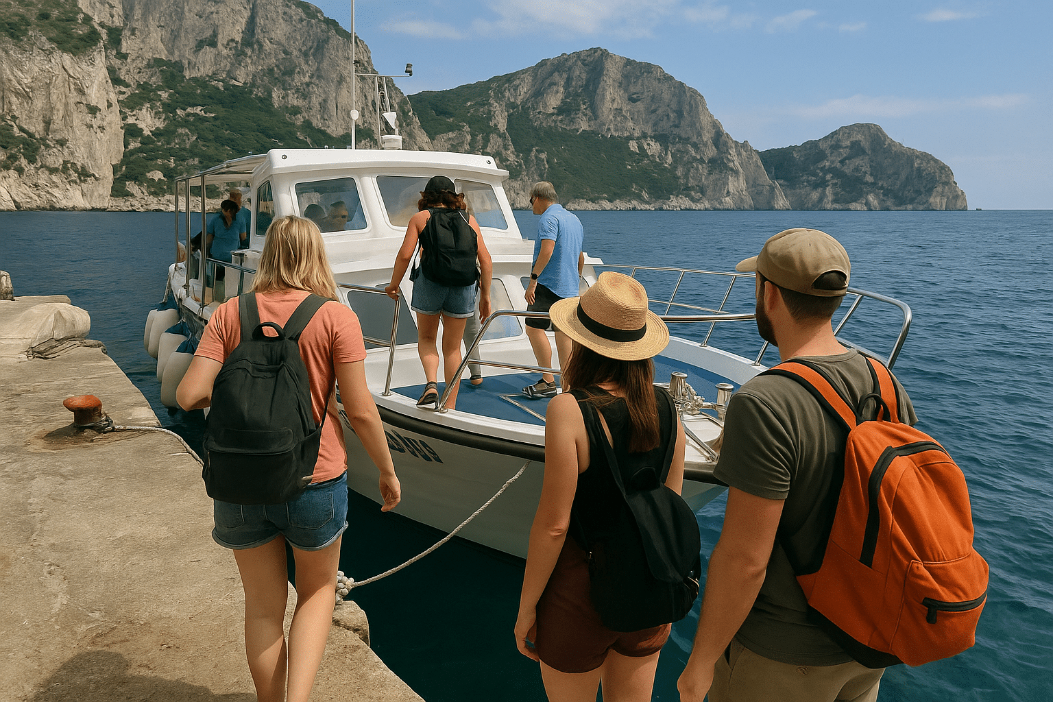
Yelapa is a small coastal village south of Puerto Vallarta that visitors typically reach by water taxi from Boca de Tomatlán or by an organized boat excursion. The ride follows a scenic section of the coast and may stop at beaches such as Las Ánimas, Quimixto, or Majahuitas.
Water taxi schedules can change with weather, demand, and operating conditions. Travelers should confirm the final departure time before leaving the dock and carry cash for fares, food, and local services. Boats may land directly on the beach, so passengers should expect to step into shallow water.
Yelapa has restaurants, walking paths, and a waterfall reached by a short inland route. The beach suits a relaxed day trip, but facilities remain more limited than those in central Puerto Vallarta.
Marietas Islands and Hidden Beach
The Marietas Islands sit near the northern entrance of Banderas Bay, several miles from Puerto Vallarta and closer to Punta de Mita. Boat excursions often combine wildlife viewing, snorkeling, and a visit near the islands’ rock formations.
Hidden Beach, also called Playa del Amor, lies inside a collapsed volcanic rock formation. Access rules protect the site, and authorities may limit visits because of conservation requirements, tides, waves, or crowd levels. Travelers should verify whether their tour includes authorized entry rather than assuming every boat can reach the beach.
Visitors may need to swim through a short rocky passage during a specific low-tide window. Operators usually provide life jackets and instructions, but the trip can involve strong sun, open-water conditions, and limited time at the beach.
Nature and Adventure Shore Excursions
Puerto Vallarta gives cruise passengers access to seasonal whale watching, forested Sierra Madre mountains, and cultivated tropical gardens. Excursion length, transportation time, physical demands, and seasonal availability vary, so travelers should check schedules before booking.
Whale Watching Season
Humpback whales typically visit Banderas Bay from December through March or early April. During this period, licensed operators take passengers from the cruise port toward deeper water, where whales may surface, breach, or display their tails. Sightings remain wildlife encounters rather than guarantees.
Small boats provide closer views but can feel more exposed in rough conditions. Larger vessels offer more stability and often include shaded seating, restrooms, and naturalist commentary. Passengers should bring sun protection, motion-sickness medication if needed, and a light jacket for the ride.
Cruise travelers should allow extra time for transportation and return boarding procedures. Responsible operators maintain legal distances, limit pursuit, and avoid disrupting whales, calves, or other marine life.
Sierra Madre Canopy Tours
Canopy tours travel into the Sierra Madre mountains outside Puerto Vallarta, where participants move between platforms using zip lines, suspension bridges, and forest trails. Most excursions include round-trip transportation, safety equipment, and instruction from trained guides.
Physical requirements differ by provider. Travelers may need to walk on uneven ground, climb stairs, brake on a zip line, or handle warm and humid conditions. Closed-toe shoes, comfortable clothing, insect repellent, and water suit the environment better than sandals or loose accessories.
Some tours combine zip lines with river swimming, rappelling, or an off-road vehicle ride. Passengers should compare minimum age, weight limits, travel time, and return guarantees before selecting a shore excursion. The excursion operator should leave enough time for the ship’s required all-aboard deadline.
Vallarta Botanical Garden
The Vallarta Botanical Garden lies south of the city in the foothills of the Sierra Madre. Its trails pass through orchid displays, native trees, palms, ponds, and restored habitat, giving visitors a quieter alternative to beach-focused shore excursions.
Visitors can explore independently or join a guided walk that explains regional plants, pollinators, and conservation work. The garden also includes bridges, shaded paths, a chapel, and a restaurant near the river. Some trails contain slopes, steps, or uneven surfaces, so comfortable walking shoes improve access.
Travelers should plan for a longer drive than central Puerto Vallarta attractions. A cruise excursion with transportation and a scheduled return offers greater protection against traffic delays, while independent visitors need to monitor the ship’s boarding time carefully.
Money, Food, Weather, and Practical Tips
Puerto Vallarta uses the Mexican peso (MXN), although many tourist businesses accept cards and U.S. dollars. Visitors can also plan for regional specialties, responsible alcohol tastings, hot weather, seasonal rain, and basic safety precautions.
Paying With Mexican Pesos and Cards
The Mexican peso (MXN) remains the most useful currency for taxis, buses, markets, small restaurants, and tips. Cruise passengers should carry smaller bills because vendors and drivers may have limited change. ATMs at banks generally offer better exchange rates than airport or hotel exchange counters, but travelers should use machines in secure, well-monitored locations.
Most established restaurants, shops, and tour operators accept Visa and Mastercard. They may still require cash for small purchases or add a card surcharge. When a card terminal asks whether to charge in pesos or the cardholder’s home currency, choosing pesos usually allows the card issuer to handle the conversion. Travelers should notify their banks before visiting Mexico and keep cash, cards, and identification in separate places.
Tequila, Mezcal, and Local Food
Tequila comes from blue agave and must meet geographic and production rules in Mexico. During a tequila tasting, visitors can compare blanco, reposado, and añejo styles, while a knowledgeable guide explains production, aging, and proper serving. They should buy sealed bottles from reputable retailers and check cruise-line rules before bringing alcohol aboard.
Mezcal uses various agave species and often has a smoky flavor, although its character varies by producer and cooking method. Local meals may include ceviche, birria, tacos, and pescado zarandeado, a marinated fish grilled over heat. Cruise passengers should choose busy, clean establishments, drink bottled or purified water, and avoid accepting more alcohol than they can safely manage before returning to the ship.
Tropical Climate, Hurricane Season, and Safety
Puerto Vallarta has a tropical climate with warm temperatures throughout the year. The wetter period usually runs from June through October, bringing short, heavy showers and high humidity. Hurricane season in the eastern Pacific officially runs from May 15 through November 30, although direct impacts on Puerto Vallarta remain uncommon; travelers should monitor official forecasts and cruise-line updates.
Light clothing, sunscreen, insect repellent, and a refillable water bottle help during shore visits. Visitors should use marked crossings, licensed taxis or arranged transportation, and well-established tour operators. They should avoid isolated areas after dark, protect phones and wallets in crowded places, and return to the ship well before its stated all-aboard time.
Frequently Asked Questions
Puerto Vallarta’s cruise terminal provides access to nearby beaches, shopping, restaurants, and transportation links. Travelers can reach downtown by bus or taxi, while independent exploration remains practical with standard precautions and attention to the ship’s departure time.
What are the best things to do near the cruise terminal?
The Marina Vallarta area sits close to the cruise terminal and offers restaurants, cafés, shops, and a waterfront promenade. Visitors can also take a short taxi ride to Playa El Salado, Los Arcos, or central Puerto Vallarta.
The Malecón features public art, ocean views, shops, and restaurants. Shore excursions commonly include snorkeling, boat trips, zip lines, food tours, and visits to nearby beaches.
Can you walk from the cruise port to downtown Puerto Vallarta?
Downtown Puerto Vallarta lies about 4 miles (6.5 kilometers) south of the cruise terminal. The distance takes roughly 15–25 minutes by taxi, depending on traffic.
Walking remains possible but is less convenient because the route follows busy roads and lacks a continuous, pleasant waterfront path. City buses and authorized taxis provide easier transportation.
How far is the cruise port from the Zona Romántica?
The Zona Romántica sits approximately 5 miles (8 kilometers) south of the cruise terminal. A taxi usually takes about 20–30 minutes, although traffic can extend the journey.
The neighborhood includes Playa Los Muertos, the Los Muertos Pier, cafés, restaurants, galleries, and hotels. Cruise passengers should allow extra time to return to the ship.
What shopping and dining options are available near the port?
Galerías Vallarta, located near the terminal, offers clothing stores, pharmacies, cafés, restaurants, and familiar international retailers. The Marina Vallarta area adds seafood restaurants, Mexican cuisine, bars, and coffee shops.
Downtown and the Zona Romántica provide larger selections of craft markets, jewelry shops, galleries, taco stands, and sit-down restaurants. Prices and opening hours vary by business.
Is it safe to explore Puerto Vallarta independently from a cruise ship?
Many cruise passengers explore Puerto Vallarta independently during daylight hours. They should use licensed taxis or established transportation services, keep valuables secure, stay in busy areas, and follow local safety guidance.
Travelers should carry only essential items and confirm the ship’s all-aboard time. Organized excursions can provide added structure for visitors traveling far from the port or participating in water activities.
Are cruise ships currently stopping in Puerto Vallarta?
Puerto Vallarta remains an active port of call on many Mexican Riviera itineraries. Current visits depend on the cruise line, ship schedule, weather, port conditions, and operational changes.
Passengers should check their cruise line’s official itinerary and voyage notifications for the most accurate information. The ship’s daily schedule takes priority over third-party listings.
Free: Pacific Coast Cruise Planning Checklist
Grab my free step-by-step checklist for planning an Alaska, Mexican Riviera, Hawaii, or Pacific Coastal cruise — sent straight to your inbox.

Mexican Riviera Tours & Excursions
Planning your shore days?
Book highly-rated shore excursions and port tours before the best ones sell out.
Find shore excursions on Viator →As a Viator affiliate, I earn a small commission from qualifying bookings — at no extra cost to you.
Cruise Packing Essentials
The little things that make cruising smoother — the gear I recommend to every traveler before they sail.
As an Amazon Associate, I earn from qualifying purchases — at no extra cost to you.