Storm Watching Near Astoria: Safe Places and Smart Timing
This post may contain affiliate links. I may earn a small commission at no extra cost to you.
Storm Watching Near Astoria: Where Safety Meets Spectacle
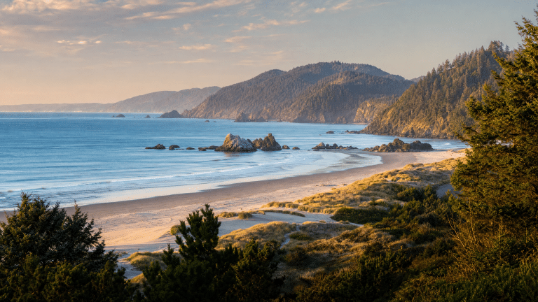
The Oregon Coast near Astoria is famous for dramatic winter storms, but many visitors don't realize that the safest and most rewarding storm watching happens from elevated, protected vantage points—not from exposed beaches where sneaker waves and wind-driven spray pose real danger. Spring shoulder-season storms offer a unique advantage: they're often less intense than deep-winter systems, but still visually impressive, and the improving weather windows make them more predictable to plan around.
Astoria's geography makes it an ideal storm-watching hub. The city sits at the mouth of the Columbia River, where Pacific swells funnel into a narrow channel, amplifying wave action and creating dramatic collisions between ocean and rivermouth. The surrounding headlands and elevated parks offer natural amphitheater views without requiring visitors to stand on exposed sand or jetties.
Why Astoria Storm Watching Is Different from Winter Extremes
Deep-winter storms (November through February) can produce waves exceeding 30 feet and winds gusting above 60 mph. These systems are visually stunning but genuinely hazardous: rogue waves, saltwater spray that stings exposed skin, and sudden wind shifts make beach exposure risky even for experienced coastal observers. Spring storms (March through May) typically peak at 15–25-foot waves and winds in the 35–50 mph range—still dramatic and photogenic, but more survivable if you're caught off-guard.
<!– ocj-affiliate-inline:ocj_trip_insurance_weather_backup –>
If weather or travel delays would be costly, compare coverage before finalizing nonrefundable bookings. This can be especially useful around the North Coast when weather, daylight, and driving time affect the plan.
Consider weather and cancellation backup
If weather or travel delays would be costly, compare coverage before finalizing nonrefundable bookings.
This article may contain affiliate links. Oregon Coast Journey may earn a commission if you book or buy through these links, at no extra cost to you.
Compare trip coverage options through approved partners such as Approved travel insurance partner via Travelpayouts or other approved network.
More importantly, spring storms are preceded by longer, more stable weather forecasts. Winter systems can develop rapidly and intensify unexpectedly. Spring systems tend to follow more predictable atmospheric patterns, giving visitors a better chance to plan viewing trips around actual storm arrival times rather than guessing.
The Best Legal and Safe Storm-Watching Spots Near Astoria
Astoria Column and Surrounding Overlook
The Astoria Column, a 125-foot monument atop Coxcomb Hill, offers one of the region's most iconic elevated views. The surrounding park grounds sit roughly 600 feet above sea level and provide 360-degree views of the Columbia River mouth, the Pacific horizon, and the surrounding headlands. During storms, you can watch swells build on the distant horizon, see rain curtains move across the water, and observe how wind direction shifts without any risk of wave impact. The site is open year-round, has ample parking, and includes a small visitor center with shelter.
Cape Disappointment Lighthouse Access (Ilwaco, Washington, 15 minutes south)
While technically in Washington, Cape Disappointment is only 15 minutes south of Astoria and offers one of the Pacific Northwest's most dramatic storm-watching experiences. The lighthouse sits on a rocky headland at the entrance to Willapa Bay, directly exposed to Pacific swells. The park includes elevated boardwalks and viewing platforms that keep visitors safely above high-tide reach. The lighthouse itself provides a windbreak, and the surrounding cliffs create natural amphitheater acoustics that amplify the sound of waves hitting rock. This spot is especially good for observing how swells refract around the cape and create complex interference patterns during storms.
Gearhart Ocean Road Overlook
About 10 miles south of Astoria, Gearhart's oceanfront road includes several pullouts and a small public park with elevated views of the beach and breaking waves. During storms, these spots offer safe, car-accessible vantage points where you can watch wave action without leaving your vehicle if weather becomes too intense. The overlook sits roughly 40 feet above the beach, high enough to avoid spray but low enough to see wave detail.
Fort Clatsop National Memorial Grounds
While primarily a historical site, Fort Clatsop's elevated grounds and river-facing views offer a sheltered alternative when direct ocean viewing becomes too intense. The site includes covered structures and is situated on a bluff overlooking the Columbia River estuary, where storm surge and tidal interaction create visible, dramatic water movement without the full force of Pacific exposure.
Reading Storm Timing: How to Plan a Safe Viewing Trip
The key to successful storm watching is matching your visit to actual storm arrival, not just hoping weather will cooperate. Here's how to read forecasts like a coastal observer:
Check NOAA Marine Forecasts, Not General Weather
National Weather Service marine forecasts (available at weather.gov) include specific wave-height predictions, wind speeds, and timing windows. A marine forecast might say “Small craft advisory 2 PM to 8 PM, waves 12–18 feet, winds 25–35 knots.” That's actionable. A general weather forecast saying “rainy and windy” tells you nothing about when peak conditions arrive.
Look for Swell Direction, Not Just Height
Oregon's North Coast faces northwest and southwest swells differently. Northwest swells (the most common winter/spring pattern) hit the coast head-on and produce the largest, most dramatic waves. Southwest swells wrap around headlands and often create confused, choppy conditions rather than organized wave sets. Check marine forecasts for swell direction and period (the time between wave sets). Longer-period swells (12–16 seconds) produce more organized, visually interesting waves than short-period wind-driven chop.
Timing: Arrive 2–4 Hours Before Peak Forecast
Most storm intensity peaks in the afternoon or early evening. If a marine forecast predicts peak conditions at 4 PM, arrive at your viewing spot by 1–2 PM. This gives you time to observe how conditions build and to retreat if weather becomes more intense than expected. Avoid arriving at peak time and trying to find parking or navigate to viewpoints while conditions are worst.
Spring Storm Season: Why It's Better for First-Time Observers
Spring (March through May) offers several advantages for storm watching:
• Longer daylight hours mean you can observe storm development from mid-afternoon through dusk without needing to drive in darkness.
• Warmer air temperatures (45–55°F) make extended outdoor observation more comfortable than deep-winter conditions (35–45°F).
• More stable forecast windows allow better trip planning. Winter storms can intensify or weaken unpredictably; spring systems follow more linear pressure-drop patterns.
• Shoulder-season lodging is cheaper and easier to book than peak winter or summer.
• Concurrent natural events—migrating gray whales, returning seabirds, coastal wildflower blooms—mean your trip has value even if storm conditions don't materialize as expected.
Essential Gear and Preparation
Even from elevated, safe viewing spots, storm watching requires specific preparation. A weatherproof jacket rated for saltwater spray and wind gusts is non-negotiable. Standard rain jackets offer poor wind resistance; look for jackets with reinforced seams, sealed zippers, and high collars that protect against spray. Binoculars rated for low-light conditions (7×50 or 10×50) let you observe wave detail and distant swell development without needing to move closer to exposed edges. Bring hand warmers, a thermos of hot liquid, and snacks—you may spend 2–3 hours observing, and comfort matters.
Consider booking lodging with ocean views, which allows you to monitor storm development from your room and make real-time decisions about when to head to viewing spots. Several Astoria-area hotels and vacation rentals offer river or ocean-facing rooms that serve as secondary observation posts.
Safety Rules That Actually Matter
Never stand on jetties, breakwaters, or exposed rocks during storms. Sneaker waves—unusually large waves that arrive without warning—kill several people annually on the Oregon Coast. Elevated parks and overlooks are safe; exposed structures are not.
Don't assume calm conditions mean safety. A deceptively calm stretch of beach during a storm often precedes a major surge. Stay on elevated ground or in your vehicle.
Check tide tables before visiting. High tides amplify storm surge and reduce the margin of safety on elevated platforms. Visit during low or mid-tide windows when possible.
Have an exit plan. If weather becomes worse than forecast, you should be able to leave your viewing spot within 5 minutes without navigating difficult terrain or waiting for traffic.
FAQ: Storm Watching Near Astoria
Q: Is spring storm watching as dramatic as winter? A: Spring storms are less intense but still visually impressive and often more predictable. Wave heights of 15–25 feet and organized swell patterns create excellent viewing without the extreme danger of deep-winter systems exceeding 30 feet.
Q: Can I watch storms from my car? A: Yes. Gearhart Ocean Road pullouts and several overlooks offer car-accessible viewing. This is actually safer than standing in open air, as your vehicle provides wind shelter and an easy retreat option.
Q: What's the best time of day to watch storms? A: Afternoon and early evening (1–6 PM) typically offer the best combination of daylight, peak storm intensity, and forecast reliability. Avoid predawn or late-evening viewing when visibility drops and weather can change rapidly.
Q: Do I need special permits to visit storm-watching spots? A: No. All recommended spots (Astoria Column, Cape Disappointment, Gearhart overlooks, Fort Clatsop) are public access. Arrive during daylight hours and follow posted rules.
Q: What should I do if I get caught in worse conditions than expected? A: Return immediately to your vehicle or the nearest shelter. Don't try to photograph or observe longer. Conditions can escalate rapidly, and your safety is the only priority.
Planning Your Astoria Storm-Watching Trip
Successful storm watching combines accurate weather forecasting, safe location selection, and realistic expectations. Start by checking NOAA marine forecasts 5–7 days in advance. When you identify a forecast window with wave heights of 12–20 feet and organized swell direction, book lodging with ocean views if possible—this lets you monitor conditions from your room and time your viewing-spot visits strategically. Pack a weatherproof jacket and binoculars, plan to arrive 2–4 hours before peak forecast conditions, and choose one of the elevated, legal viewing spots listed above.
Spring storm watching near Astoria offers the rare combination of dramatic natural spectacle, manageable safety risk, and genuine learning opportunity. You'll leave with a deeper understanding of coastal weather patterns, the power of Pacific swells, and why the Oregon Coast has always demanded respect from those who visit it.
Editorial transparency
This article was drafted with AI assistance and reviewed through Oregon Coast Journey publishing safeguards. Always confirm current conditions before traveling.