The Story Behind Charleston and Why Visitors Notice It
This post may contain affiliate links. I may earn a small commission at no extra cost to you.

Why Charleston Exists Where It Does
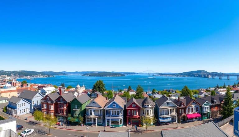
Charleston sits on Coos Bay's protected waters, about 12 miles south of Coos Bay proper, and that geography is everything. In the 1890s, when timber and fish were the currency of the Oregon Coast, Charleston's deep-water harbor and sheltered anchorage made it the natural choice for a working port. Unlike many coastal towns that pivoted to tourism or faded entirely, Charleston doubled down on its fishing identity—and it still does.
The town was platted in 1891 and named after Charleston, South Carolina, by early settlers who recognized the harbor's commercial potential. What makes Charleston historically significant isn't a single dramatic event or famous lighthouse (though the Cape Arago Lighthouse sits nearby). Instead, it's the *continuity* of working maritime life. Walk the docks today and you'll see commercial fishing boats, crab processors, and active marine supply operations—the same economic engine that built the town 130 years ago.
The Working Waterfront: What You'll Actually See
Most Oregon Coast towns have *tourist waterfronts*. Charleston has a *working* waterfront, and that distinction matters. When you visit, you're not looking at a reconstructed maritime village or a sanitized harborfront promenade. You're looking at a place where people make their living from the ocean.
<!– ocj-affiliate-inline:ocj_lodging_finder –>
If you are building a weekend around this part of the coast, compare nearby lodging before finalizing the route. This can be especially useful around the South Coast when weather, daylight, and driving time affect the plan.
Where to stay near this Oregon Coast stop
If you are building a weekend around this part of the coast, compare nearby lodging before finalizing the route.
This article may contain affiliate links. Oregon Coast Journey may earn a commission if you book or buy through these links, at no extra cost to you.
Compare nearby stays through approved partners such as Booking.com, Travelpayouts lodging partners.
The Charleston Marina and the surrounding docks are home to commercial fishing vessels—primarily crab boats, which dominate the winter and spring seasons. During crab season (typically December through June, peaking in winter), the docks buzz with activity: boats unloading catch, processors sorting and packing, trucks moving product inland. Spring brings a secondary surge as Dungeness crab and other species remain marketable and whale migration season draws both marine life and visitors.
This isn't quaint. It's real. And that authenticity is exactly why visitors who care about coastal history find Charleston more interesting than polished resort towns. You're seeing the actual economic foundation of the Oregon Coast—the work that sustains communities when tourism dollars fluctuate.
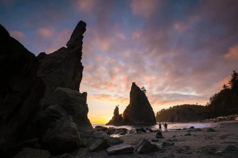
The Lighthouse Context and Navigation History
Charleston itself doesn't have an iconic lighthouse, but its position on Coos Bay places it within the operational range of the Cape Arago Lighthouse, located about 6 miles southwest on Cape Arago. That lighthouse, automated in 1963 and still active, represents the navigational infrastructure that made Charleston's harbor safe and economically viable.
Before electronic navigation, lighthouses were the difference between a successful harbor and a graveyard. Coos Bay's entrance is notoriously tricky—sandbars shift, fog rolls in thick and fast, and currents can be unpredictable. The Cape Arago light, along with range markers and buoys, created a navigable corridor that allowed fishing boats and cargo vessels to enter and exit safely. Charleston's prosperity was built on that lighthouse infrastructure, even though the light itself sits outside town.
Visitors interested in lighthouse history should know that Cape Arago is one of Oregon's most photogenic and accessible lighthouses, and understanding its relationship to Charleston's harbor adds context to why the town exists and why it matters. The light isn't just a scenic object—it's the reason Charleston could develop as a working port.
Spring Seasonality and Visitor Experience
Spring is a particularly good time to visit Charleston and understand its character. Whale migration season (March through May) brings gray whales close to the coast, and many migrate through or near Coos Bay. The combination of active fishing season and whale activity creates a dynamic environment: you'll see fishing boats preparing for the day, whale-watching tours launching from nearby docks, and the kind of marine activity that illustrates why this coast matters ecologically and economically.
Spring weather on the South Coast is changeable—expect rain, fog, and clear days in quick succession. That variability is part of the coastal reality. Bring layers and waterproof gear, and plan flexible timing for outdoor activities. The shoulder season also means fewer tourists and more authentic interactions with locals who work in fishing, marine services, and hospitality.
Wildflower activity in spring extends slightly inland from Charleston toward the coastal ridges and state parks in the region. While Charleston itself is primarily a working waterfront, the surrounding South Coast offers excellent spring hiking and wildflower viewing at nearby state parks and preserves.
Museums, Local Knowledge, and Deeper Dives
For visitors wanting to deepen their understanding of Charleston's history and the broader Coos Bay maritime story, the Coos Historical and Maritime Museum (located in nearby Coos Bay) provides excellent context on logging, fishing, and indigenous history of the region. The museum's collections include maritime artifacts, photographs of early Charleston, and documentation of the area's economic transitions.
If you're planning a visit to Charleston, consider pairing it with a stop at the museum, a walk of the active docks (respectfully—this is a working space, not a theme park), and a day trip to Cape Arago Lighthouse or nearby Shore Acres State Park. This combination gives you the full picture: working maritime history, navigational infrastructure, and the natural landscape that made settlement possible.
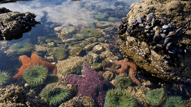
For gear and planning, bring a good tide table and weather forecast app. Coos Bay's tides are significant (up to 8 feet), and understanding tidal timing helps you plan dock walks, nearby tide pool exploration, and safe beach access. The Oregon Coast's changeable spring weather demands good rain gear and layered clothing.
Why Charleston Matters Beyond the Postcard
Charleston represents something many visitors miss when they focus on scenic overlooks and famous landmarks: the actual, working Oregon Coast. It's a place where economic survival still depends on the ocean, where boats leave at dawn to fish, and where the infrastructure built 130 years ago still functions because it was built to last and adapted to change.
Understanding Charleston's history—its harbor geography, its lighthouse infrastructure, its continuous fishing economy—teaches you how the Oregon Coast actually works. It's not a story of decline or nostalgic preservation. It's a story of adaptation and continuity. And that makes Charleston worth a visit, especially in spring when the season's energy is visible on the docks and in the surrounding waters.
Frequently Asked Questions
Can I walk the Charleston docks and watch fishing boats?
Yes, but respectfully. The docks are working spaces, not tourist attractions. Walk the public areas, observe from a distance, and don't interfere with active operations. Early morning (5–7 AM) is peak activity time during crab season.
What's the best time to visit Charleston to see fishing activity?
Winter through early spring (December–June) is crab season, when the docks are busiest. Spring (March–May) combines fishing activity with whale migration season and fewer crowds than summer.
Is Cape Arago Lighthouse accessible from Charleston?
Yes. Cape Arago is about 6 miles southwest via Highway 101 and Cape Arago Highway. The lighthouse is automated and visible from nearby viewpoints; the grounds are accessible during daylight hours.
What should I know about spring weather in Charleston?
Expect fog, rain, and clear spells in quick succession. Temperatures range from 45–55°F. Bring waterproof layers and plan flexible timing for outdoor activities.
Are there tide pools or beaches near Charleston?
Yes. Shore Acres State Park and nearby coastal beaches offer tide pools, hiking, and ocean views. Check tide tables before visiting tide pools—spring tides (which occur during new and full moons) offer the best access to lower tide zones.
Editorial transparency
This article was drafted with AI assistance and reviewed through Oregon Coast Journey publishing safeguards. Always confirm current conditions before traveling.
Related Oregon Coast planning links
- The Story Behind Charleston and Why Visitors Notice It
- Oregon Coast Escape Plan the Perfect Trip
- 2025 Oregon Coast Vacation FAQ: Everything You Need for a Perfect Trip
Official resources to verify before you go
- Oregon State Parks coastal recreation updates
- South Coast visitor information from Travel Oregon
- NOAA tide and current information
Optional partner planning link: compare Oregon Coast tours and activities. Always compare current prices, terms, and cancellation details before booking.
Free: Pacific Coast Cruise Planning Checklist
Grab my free step-by-step checklist for planning an Alaska, Mexican Riviera, Hawaii, or Pacific Coastal cruise — sent straight to your inbox.