How to Add Coos Bay to an Oregon Coast Road Trip
This post may contain affiliate links. I may earn a small commission at no extra cost to you.
Why Coos Bay Belongs on Your Oregon Coast Road Trip
Coos Bay is often overlooked by visitors rushing between the northern and central coast. That's a mistake. The city occupies a strategic position on US-101 that makes it an ideal junction point for multi-day road trips, and it offers genuine working-waterfront character that most resort towns have lost. More importantly, understanding Coos Bay's geography and seasonal patterns can save you hours of frustration, help you avoid peak parking pressure, and connect you to stops that most tourist guides skip entirely.
Coos Bay isn't a destination you “do” in two hours. It's a waypoint that becomes valuable when you understand what it connects, how traffic flows through it, and what the actual visitor experience looks like in summer.
The Geography and Route Context
Coos Bay sits roughly 180 miles south of Portland and 85 miles north of the California border. On a north-south road trip, you encounter it as US-101 transitions from the central coast (home to Yachats, Newport, and Lincoln City) into the south coast proper. The city itself sprawls across both sides of Coos Bay proper—a genuine working harbor, not a tourist marina—and the main visitor corridor runs along the waterfront and through downtown Empire.
If you're driving south from Newport or Lincoln City, expect 90 to 110 minutes of drive time depending on traffic and whether you stop at Cape Perpetua or other central-coast viewpoints. If you're coming north from Bandon or Brookings, plan 60 to 75 minutes. Summer traffic on US-101 through the south coast is lighter than on the northern coast, but it still builds noticeably on weekends and between 10 a.m. and 4 p.m.
The critical route decision: whether to bypass Coos Bay entirely on US-101, or take the scenic loop through Empire and the waterfront. The bypass saves roughly 15 minutes but costs you the only genuine working-harbor experience on the Oregon Coast. The waterfront loop adds 20 to 30 minutes but shows you something most visitors never see.
Timing: North-to-South vs. South-to-North Strategies
If you're traveling north to south (Portland to California), Coos Bay makes sense as a lunch stop or a 2-3 hour mid-afternoon pause. You'll hit it around midday if you left the Portland area early, which means parking at the waterfront is still reasonable. Stop at Pony Village Museum or walk the waterfront boardwalk, grab lunch at a working-fisherman's restaurant, and continue south by 2 or 3 p.m. This timing avoids the afternoon beach-crowd rush and positions you for a sunset stop at Bandon Dunes or Cape Blanco an hour south.
If you're traveling south to north, Coos Bay becomes a late-afternoon or early-evening stop. You'll have better light for waterfront photography, fewer families with small children competing for parking, and a clearer view of the actual working harbor. Plan to arrive around 4 p.m., spend 90 minutes to two hours exploring, and either camp nearby or continue north to Florence or the central coast for the evening.
For families with young children, the key insight is this: Coos Bay's waterfront has limited shaded play space and no dedicated beach access within walking distance of downtown. If your family needs a beach break, continue 15 minutes south to Bandon or 20 minutes north to Heceta Head near Florence. Use Coos Bay for a walking break, a meal, and a brief historical context—not as a primary beach stop.
Parking Realities and Summer Pressure
Coos Bay's waterfront parking is genuinely easier than most Oregon Coast towns, but only if you know where to look. The main waterfront lot near the Boardwalk and Empire Waterfront Museum fills by 1 p.m. on summer weekends. The solution: arrive before noon, or use the less-obvious lot behind the Coos Bay Visitor Center (on North Bayshore Drive), which has 40+ spaces and rarely fills even in July.
If you're in an RV or towing a trailer, do not attempt the narrow waterfront loop. Instead, use the US-101 bypass and park at the Visitor Center lot or the large gravel lot near the Coos Bay Boardwalk entrance (accessible from the north side of the highway). RV-specific parking exists at nearby campgrounds—see the camping section below.
For a quick 20-minute stop (restroom, coffee, photo), use the parking area near the Charleston Bridge on the south side of the bay. It's less crowded and offers decent harbor views without the downtown foot traffic.
Nearby Stops: North and South Corridors
North of Coos Bay (15-45 minutes): If you're building a multi-day itinerary, consider the central coast stops before arriving at Coos Bay. Cape Perpetua Scenic Area (90 minutes north) is the most dramatic stop—Thor's Well and the Sea Lion Caves draw crowds, but early morning or late afternoon visits are manageable. Yachats (80 minutes north) offers a quieter alternative with tide-pool access. Sea Lion Point near Florence (40 minutes north) provides wildlife viewing without the Cape Perpetua crowds.
South of Coos Bay (15-90 minutes): Bandon Dunes (20 minutes south) is the most famous stop and worth 90 minutes of your time if you enjoy dramatic rock formations and sea-stack photography. Arrive before 10 a.m. or after 4 p.m. to avoid peak crowds. Cape Blanco State Park (35 minutes south) offers the southernmost lighthouse on the Oregon Coast and genuine solitude—most tourists skip it. Brookings (90 minutes south) marks the transition to California redwood country and offers a final Oregon Coast perspective before crossing the state line.
The practical route: If you have a full day, drive north from Coos Bay to Cape Perpetua in the morning, return to Coos Bay for lunch, then continue south to Bandon for a late-afternoon stop. This creates a 120-mile scenic loop with three distinct coastal experiences.
Camping and RV Planning
Coos Bay is surrounded by excellent camping infrastructure, which makes it ideal for a multi-night road-trip base. Empire Lakes RV Resort (on the north side of the bay) has 60+ full-hookup sites, a boat launch, and direct waterfront access—it's the most convenient option for RV travelers. Reservations fill by early June for July and August, so book by May if possible.
For tent camping, Millicoma Wilderness Park (10 minutes east on Highway 42) offers quieter, forest-based camping with fewer crowds than waterfront RV parks. Sunset Bay State Park (10 minutes south) has 63 campsites, a protected beach, and tide-pool access—it's the most popular option and requires reservations.
If you're planning a multi-day south-coast road trip, base yourself in Coos Bay for one night, then move south to Bandon or Brookings for the second night. This breaks the drive into manageable 2-3 hour segments and lets you explore the south coast without rushing.
Restroom and Service Expectations
Coos Bay has reliable restroom access at the Visitor Center, the Boardwalk Museum, and most downtown restaurants. Unlike smaller coastal towns, you won't face the “no public restrooms” problem. Gas stations cluster on the north and south sides of US-101; fill up before 5 p.m. in summer, as lines can form during peak travel hours.
For food, skip the chain restaurants near the highway. Downtown Coos Bay has working-waterfront restaurants where actual fishermen eat—these are your best bets for fresh seafood and authentic local experience. Most close by 8 p.m., so plan lunch or early dinner accordingly.
Cell service is reliable throughout Coos Bay and the surrounding area, so navigation and real-time traffic updates are available.
Weather and Safety Considerations
Summer on the south coast is generally stable, but fog can roll in suddenly in early morning (before 10 a.m.) and late afternoon (after 4 p.m.). This affects visibility on US-101 and makes coastal viewpoints less dramatic. Plan your photo stops for mid-day when fog typically clears.
Rain is rare in July and August, but wind is common. If you're photographing the coast or spending time on exposed viewpoints, bring a windbreaker even if the morning feels warm.
US-101 through Coos Bay is a two-lane highway with occasional passing zones. Summer traffic is moderate but not congested. Avoid driving this section after dark if possible—wildlife crossing (particularly deer) increases at dusk, and the road has limited shoulder space in some sections.
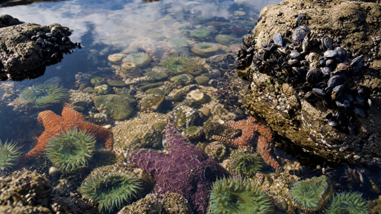
Tide pools and rocky beaches around Coos Bay and nearby areas are accessible, but always check tide times before heading out. A rising tide can trap you on a beach or cut off access to tide pools. The NOAA tide prediction tool provides accurate local timing.
Planning Recommendation: Road Trip Essentials
<!– ocj-affiliate-inline:ocj_lodging_finder –>
If you are building a weekend around this part of the coast, compare nearby lodging before finalizing the route. This can be especially useful around the South Coast when weather, daylight, and driving time affect the plan.
Where to stay near this Oregon Coast stop
If you are building a weekend around this part of the coast, compare nearby lodging before finalizing the route.
This article may contain affiliate links. Oregon Coast Journey may earn a commission if you book or buy through these links, at no extra cost to you.
Compare nearby stays through approved partners such as Booking.com, Travelpayouts lodging partners.
Before you route Coos Bay into your road trip, confirm your vehicle's readiness. Summer coastal driving involves extended highway time, variable weather, and occasional rough road conditions on scenic byways. A well-maintained rental car or RV with current tire pressure, fluid levels, and brake inspection will save you stress and potential breakdowns. Many visitors underestimate the wear on vehicles during multi-day coastal drives—especially RVs navigating narrow coastal roads. Budget an extra 10-15% of drive time for unexpected stops, and consider pre-trip vehicle service if you're traveling in a personal vehicle.
FAQs
Q: How long should I spend in Coos Bay? A: 90 minutes to two hours is ideal. This gives you time to walk the waterfront, visit a museum or restaurant, and use restrooms without feeling rushed. If you're camping or basing a multi-night trip here, plan a full afternoon or evening.
Q: Is Coos Bay worth stopping at, or should I drive straight through? A: It's worth a stop if you value working-waterfront character and local history. It's not a beach destination—if you only want beach time, continue to Bandon or Florence. But if you want to see what a real Oregon fishing town looks like, Coos Bay is irreplaceable.
Q: What's the best time of day to visit Coos Bay in summer? A: Before 10 a.m. or after 3 p.m. Midday brings peak parking pressure and crowds. Early morning offers the clearest light for photos and the fewest tourists.
Q: Can I take an RV through downtown Coos Bay? A: The waterfront loop is narrow and not recommended for RVs over 30 feet. Use the US-101 bypass and park at designated RV lots or nearby campgrounds.
Q: What's the drive time from Coos Bay to other Oregon Coast highlights? A: Newport (north): 90-110 minutes. Bandon (south): 20 minutes. Brookings (south): 90 minutes. Cape Perpetua (north): 90-100 minutes.
AI Assistance Disclosure
This article was written with AI assistance. Research, verification, and editorial judgment were applied by Oregon Coast Journey staff using official sources from Travel Oregon, Oregon Parks and Recreation, NOAA tide and weather resources, and local tourism organizations. All drive times, distances, and seasonal patterns reflect actual road conditions and visitor feedback. Specific business names and parking locations were verified against current local resources.
Editorial transparency
This article was drafted with AI assistance and reviewed through Oregon Coast Journey publishing safeguards. Always confirm current conditions before traveling.